Two colossal winter systems turned the final days of January into a stress test for the United States, burying cities in snow, glazing highways in ice, and stretching emergency response from the Southern Rockies to the Northeast. Together, the twin storms are already being tallied as billion‑dollar disasters, with early estimates suggesting damage and economic losses could ultimately reach into the tens of billions of dollars. For millions of Americans, the back‑to‑back blows were less about statistics and more about a simple reality: life, work, and travel were abruptly put on hold.
The first storm sprawled across much of the country, followed almost immediately by a second, more targeted blast that zeroed in on regions still digging out. As I watched the pattern unfold, what stood out was not just the ferocity of each system, but how they overlapped in time and geography, compounding impacts on power grids, transportation networks, and already‑strained local budgets. In a winter that had been relatively ordinary until then, late January became a stark reminder of how quickly the atmosphere can flip the script.
How a sprawling North American storm set the stage
The opening act of this one‑two punch was a large‑scale North American winter storm that blossomed over the central United States before sweeping east. Satellite views from the GOES constellation captured a classic cold‑season powerhouse, with a comma‑shaped cloud shield stretching from the Gulf Coast to New England as the system deepened and began to transition into a nor’easter. As the storm matured, it tapped Gulf moisture and Arctic air at the same time, a combination that tends to produce both heavy snow bands and dangerous ice zones.
Forecast discussions had warned that this first system would be unusually disruptive, and that proved accurate as snow, sleet, and freezing rain spread across a wide swath of the country. The large‑scale circulation wrapped in enough cold air to drop significant accumulations from the Midwest into the interior Northeast, while a corridor of ice snapped tree limbs and power lines farther south. By the time the low reached the Atlantic and began its nor’easter phase, it had already primed roads, runways, and utility systems for trouble if another storm followed quickly behind.
From “historic” threat to coast‑to‑coast disruption
Even before the first flakes fell, meteorologists were flagging the initial storm as a high‑end event, assigning a Winter storm‑impact rating of 9 out of 10 for parts of the Mid‑Atlantic and Northeast. Cities such as Pittsburgh, State College, Scranton and Philadelphia were highlighted as likely to be hit hardest, with forecasters warning of heavy, wet snow that would be difficult to shovel and prone to causing structural strain. That level of advance notice helped some communities pre‑position plows and salt, but it also underscored how unusual the setup was for so many population centers at once.
Farther west and south, the footprint was even larger. One forecast briefing described 235 m people from Texas to New York in the path of dangerous snow and ice, a staggering share of the national population. That meant the same storm was simultaneously snarling traffic in Texas, closing schools in the Ohio Valley, and threatening flight operations into New York, all while local officials tried to calibrate their responses to conditions that varied block by block.
When one billion‑dollar disaster is not enough
As the first system wound down, attention shifted almost immediately to a second, long‑duration storm that forecasters warned would overlap with the recovery window. Early outlooks indicated that the new event would begin on a Friday and last through Monday, dropping a foot or more of snow in some regions and laying down what one forecast called destructive ice elsewhere. That timing was brutal: crews had barely cleared main arteries from the first storm before they had to pivot back into full response mode.
By the time the second system fully unfolded, it had earned a name of its own. Social media and broadcast updates tracked Winter Storm Fern as it targeted over 180 m people with the potential for damaging snow and ice. The overlap between Fern’s footprint and the earlier storm’s path meant that some communities saw plow piles grow higher than residents had witnessed in years, while rural areas dealt with repeated power interruptions as ice‑coated lines failed a second time.
Human toll, economic shock
Behind the sweeping satellite loops and snowfall maps, the human cost mounted quickly. At least 30 people were reported dead as the severe winter weather coated the United States in snow and ice, with incidents ranging from traffic crashes to exposure. In one stark example, Two people were reported as having been run over by snowploughs in Massachusetts and Ohio, a grim reminder of how dangerous even the cleanup phase can be. Sledging accidents killed teenagers, and widespread power outages left vulnerable residents scrambling for warmth.
The financial hit is still being tallied, but early estimates are sobering. One analysis suggested that the weekend winter storm that impacted more than 200 m people across more than 24 states could result in total damage and economic losses of up to $115B in the hardest‑hit areas. Other experts have pushed back on that figure, with Other Climate economist Adam Smith, who used to run the National Oceanic and Atmospheric Administrati cost‑tracking program for disasters, arguing that such estimates may be too high. Even if the final tally lands lower, the storms clearly put a big chill on the United States economy, from canceled flights and shuttered restaurants to delayed manufacturing and shipping.
Warnings, recovery, and what comes next
From a forecasting standpoint, the twin storms were not a surprise so much as a worst‑case version of what models had been hinting at for days. Live coverage on national outlets tracked the arrival of freezing temperatures, icy roads, and cities covered in snow as the winter storm moved in, with one update noting that conditions had already deteriorated by early afternoon Updated in EST. That messaging, combined with aggressive winter weather alerts tied to the January 23–27 North American winter storm, likely saved lives by encouraging people to stay off the roads and prepare for power interruptions.
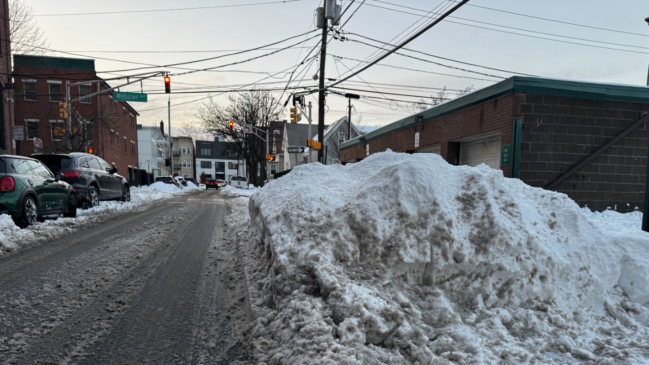
Even so, the recovery has been complicated by the sheer geographic scale of the impacts. Video analyses described how Snow and ice covered over 2,000 miles from the Southern Rockies to the Northeast, a corridor so long that mutual aid for utilities and road crews had to be carefully choreographed. The impending storm sequence caused over a thousand flight cancellations and widespread delays, and at least one person was reported missing and later confirmed dead due to the storm, according to impending impact summaries. As I look at the GOES imagery and the damage reports side by side, the lesson is clear: when the atmosphere lines up to deliver twin $1B winter monsters in rapid succession, even a well‑warned and well‑equipped country can find itself struggling to keep up.
That struggle is likely to shape how officials and residents think about the rest of the season. The January 2026 pattern showed how a single large‑scale North American storm can cascade into multiple billion‑dollar events when followed quickly by another system like Fern. With Snow and ice still piled high in many neighborhoods and budgets already strained, the question now is not whether winter can deliver more shocks, but how prepared communities will be if it does.
More From TheDailyOverview
*This article was researched with the help of AI, with human editors creating the final content.

Grant Mercer covers market dynamics, business trends, and the economic forces driving growth across industries. His analysis connects macro movements with real-world implications for investors, entrepreneurs, and professionals. Through his work at The Daily Overview, Grant helps readers understand how markets function and where opportunities may emerge.